Last week I spent seven days in the Wind River Range with Sagar, my Dad, and one of his co-workers, named Bob.
We left Cheyenne early Friday morning, and stopped in Pinedale at a quintessential small-town American burger stand–the Sugar Shack–and loaded up on beef and milk-shakes for the week. Driving up the steep, winding road to the Elkhart Park trailhead, we stopped off to take in the panorama of the Wind River Range– running some 210km through western Wyoming. Flagging down an impromptu photographer, we smiled and let the Winds fill the background.
We parked in the half-empty parking lot, signed into the trailhead register, and set off– our packs loaded down, but with a spring in our step. We hiked through the warm afternoon, stopping off at the aptly named Photographer’s Point for a spanning view of the range we’d soon come to call home. We camped at Hobbs Lake, on a shelf some 50′ above the water’s edge. Our tent faced out, over the water.
Our first “objective” was to hike Fremont Peak– Wyoming’s third highest peak (behind Gannet Peak’s 4,207m and Grand Teton’s 4,198m) climb, and highest non-technical ascent, measuring in at a respectable 4,189m (13,743′). We camped out at the base of Titcomb Basin the night before. We set out for the peak at 7:00am. By 11:00 we had reached the “saddle,” where the “real” climb began. Sucking hard on the oxygen-thin air, we went up, up, up– over the jagged boulders and sliding shale. A veritable gale wind greeted us at the top, adding to the vertigo of the 500m dropoff to the Upper Fremont Glacier below. The view was indescribable– jutting peaks, shear walls of rocks, massive glaciers– stretching to the horizon in three directions
At the top, there’s a canister with a “sign-in” book for everyone who climbs the peak. Jerry and I added our names: a week since the last entry, and only a few pages after Jerry’s previous entry– from August 2005.
Looking at our map the next day, we concluded that we could save ourselves a few miles by taking a cut-off along side the river that fed out of Island Lake, rather than walking back to the Indian Basin turnoff and then to Fremont Crossing. We followed a well-worn outfitter trail for a while, which led us to a beautiful campsite on the northern edge of Island lake. From there on, the trail petered out and we just followed the river. There were two points along the way where we had to resort to class-5 climbing (with our packs on, mind you!), but we all made it to the other side.
Bob’s comment was: “Whew! That scared the daylights out of me! I’ve never done anything that technical before.”
Sagar’s comment was: “Wow! That was awesome. The next time someone asks me if I want to take a short-cut through the Winds, my answer will be ‘yes!'”
Passable? Yes. But only on foot, and not for the faint hearted!
Being in the bushwhacking state of mind, we bushwhacked our way to Big Water Slide (about 1 km SW of Fremont Crossing) and set up camp. The fishing in the pond at the slide’s base was fair, and we had fish for dinner.
The highlight of the trip, for me, was seeing the fish jump at Big water Slide. I’ve read, of course, about Alaskan Salmon swimming miles upstream to deposit their eggs, but to see it… The fish were trout, of course, but always something like this: a fish would vault itself out of the water, into the air– a meter or more, in a perfect arc, up the slide. Smacking into the rock, it would struggle with incredible vigour against the crushing flow of the slide, trying to swim faster up than the pounding down of the water. Invariably, the fish would be pushed back down, but invariably, another fish would try, and another, and another… such tenacity and strength!
From Big Water Slide we followed the Highline Trail (also aptly named, seldom dipping below 10,000 feet!) to the base of Stroud Peak. We camped on the tundra in Shannon Pass, without a tree in view. From the top of Stroud Peak (3,718m) our brightly colored tents at “base camp” were entirely lost in the expansive rocky perfection of the tundra.
Heading back below tree-line the next day, we hiked toward Bomar Lake. I hiked with Sagar, and Jerry with Bob. We were separated along the way, (a wrong turn) but, fortunately, if all roads in Europe lead to Rome, then all trails in the Winds must lead to Bomar Lake– where we met up an hour later, by different paths. Jerry sampled the fishing after lunch, and then we headed down the trail to Trapper Lake, for our last night in the woods. Jerry and I fished without much luck, aside from a dozen or so fish that were just large enough to wrap their mouth around our flies– six inches, at most.
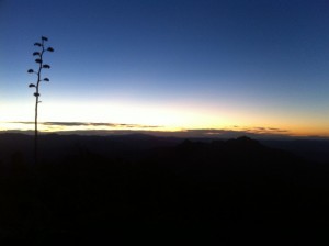
We roasted marshmallows and stayed up as the sun went down. The lake was beautiful: as Conrad writes: “a change came over the waters, and the serenity became less brilliant but more profound.” The sky gradually darkened, and I found myself smiling to look at the trail below– an 18 inch strip of boot-trodden dust: our super-highway, our way here, our way home. The lake, beyond, was dotted with the rippling rings of bouncing insects and feeding fish– as calm and quiet as the shore and rising trees on the other side.
Unmolested, unpolluted and untarnished, I wondered how many times more I’ll enjoy such incomparable beauty, how many more times my heart will be equally at rest. I reflect the past with great reverence for those like Presidents Grant and Teddy Roosevelt, by whose efforts the Bridger wilderness has been preserved. And, I look to the future with no small trepidation– trepidation of development, encroachment, pollution, destruction. This year alone, President Bush cut funding for national parks by $100 million, funding for the Clean Water Act by $200 million, and funding for the Forest Service by an additional $107 million, while ignoring international efforts to reduce carbon monoxide emmissions and other pollution. But for now, our wilderness areas remain untouched by human hands. In the morning we scattered our firepit, leaving no trace that we had been, and again took to our trail.
We hiked out, the last day, on the unmaintained Pine Creek Trail. The trail was difficult, but our packs were light and showers and soft beds drew us on. We made the last 10 miles (and 4,500′ of vertical climbing) in great time, and we were soon enjoying the plentiful water at the trail head.
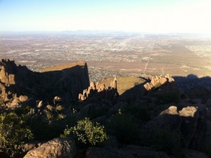
We stopped on the way down to look back and identify the peaks we had climbed and the route we had taken. It was a week well enjoyed, in a range of majestic mountains– mountains I am marvelously privileged to have access to.
—
Select photos are available here.
Many thanks to my Dad for planning and organizing the trip!