42: Colorado High Country
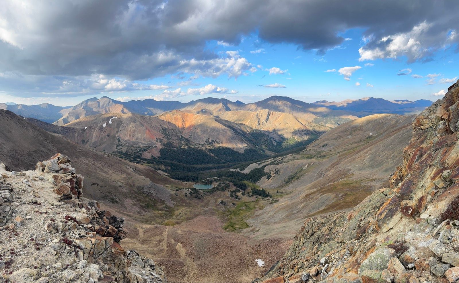
Colorado’s high country stands out as if a towering peak on the elevation profile of the CDT, exceeding 14,000’ (though my bike-legal route will top out at more like 13,200’).
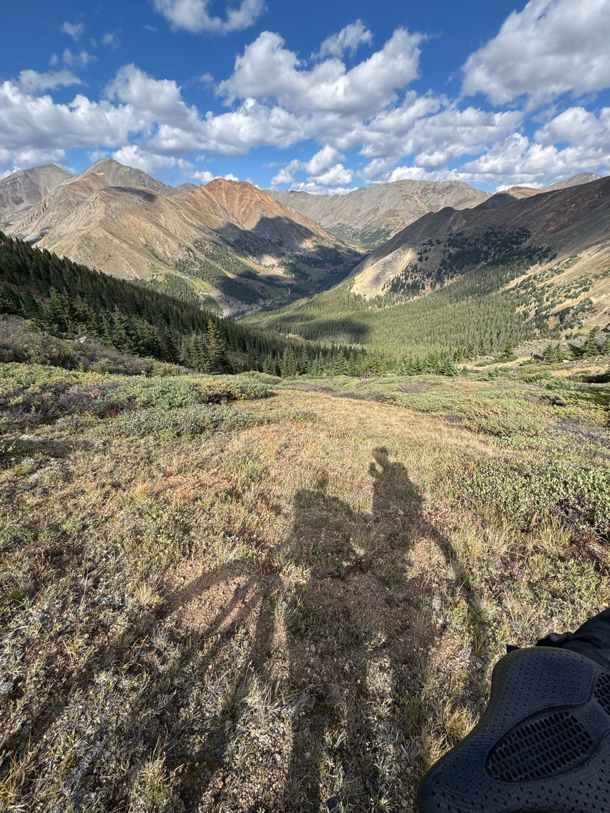
After a second breakfast on my way out of Georgetown under blue skies and a warm sun, I steadily cranked out the 4,700’ climb up to Argentine Pass. Rejoining the CDT proper, I enjoyed the quick descent and began the next climb up with some uncertainty if I would be coming back down the same way in a few hours.
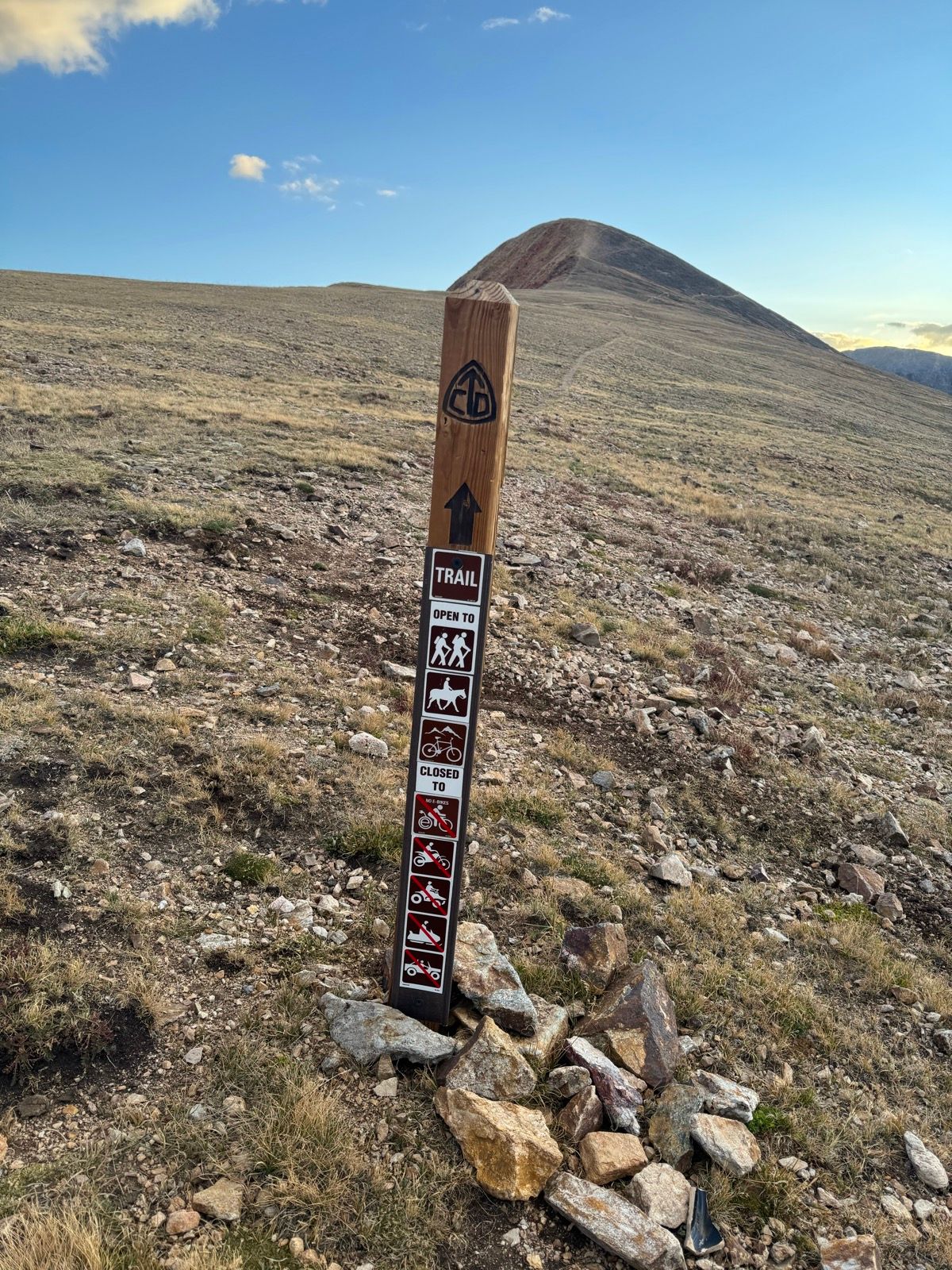
I had received contradictory information about the bike legality across this section of high terrain. Cotrex (the incredible government-sponsored one stop shop resource for all things Colorado trails) indicated that these trail sections were open to bikes. It was very much to my relief this afternoon to also find the official forced service sign post indicating that the trail was open to bikes. It actually makes perfect sense that this zone would be bike legal, given the extensive mining history and current motorized access in the area. For all that this area is a spectacular alpine zone, a pristine wilderness it is not.
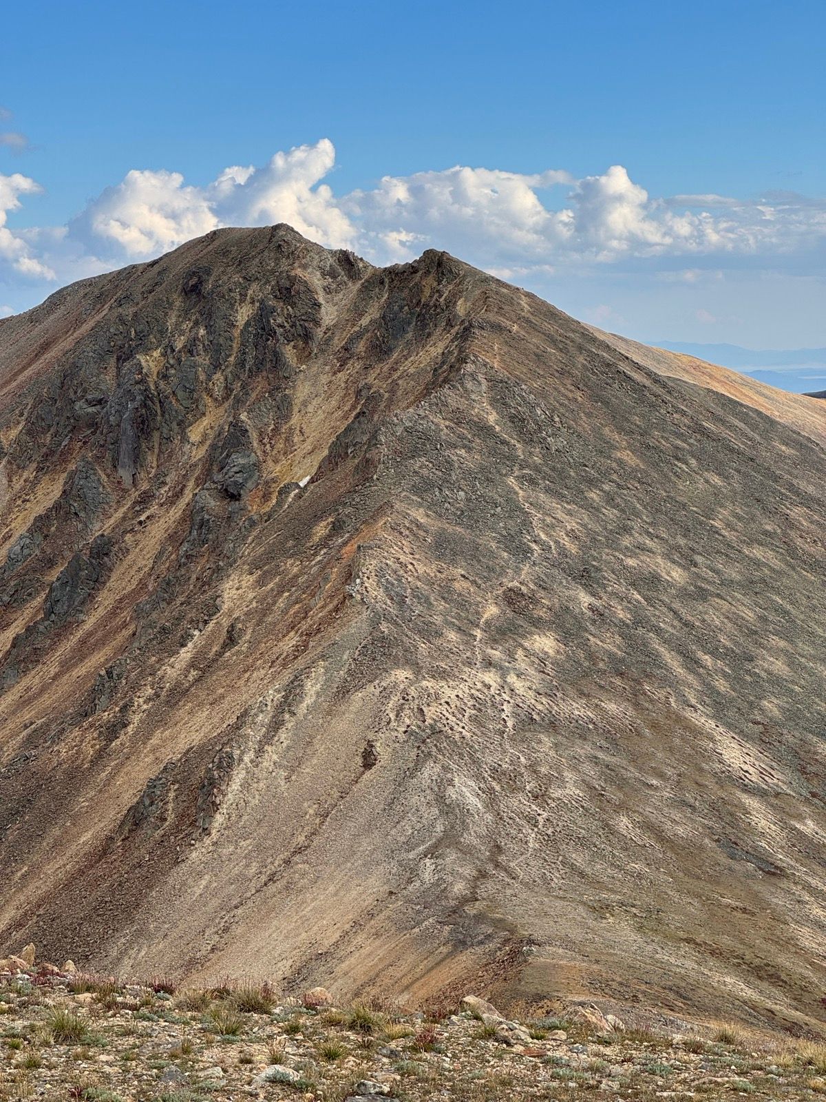
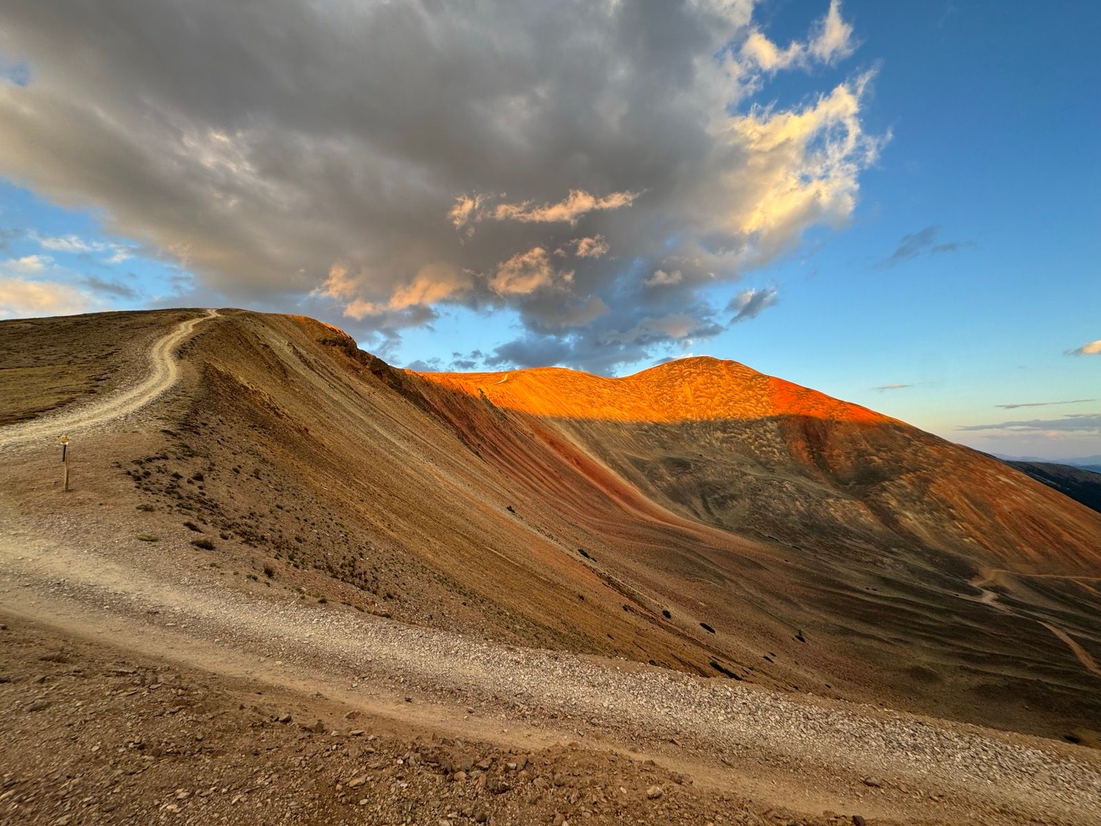
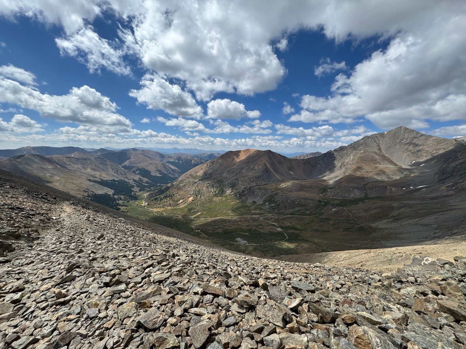
The trail since Santa Fe Peak has varied among nonexistent but rideable, steep hike a bike, a few scrambling sections of carrying my bike across my shoulders, and some fun, fast downhill single track to round things out. I’m making slow progress through this section (as I expected) but am thrilled to be here. Tomorrow I will finish out the second half of this high traverse and connect to the Colorado Trail.